


 063: Reconstruction of the ancient harbours of Menorca: GIS, LIDAR, bathymetry and underwater archaeology (Ciutadella, Menorca - Spain)

Useful Information
Directed at
Students and graduates in archaeology, history, anthropology, geography, environmental sciences, nautical studies or related disciplines who wish to add to their training the digital heritage-documentation techniques applied to the coast and to ancient harbours, and anyone interested in maritime and underwater archaeology who would like a first field experience in Menorca.
No prior knowledge of archaeology or of the software is required, and no diving skills are needed either, since the work takes place in the laboratory, on land walking along the coast and, for the bathymetry of the four case studies, on the surface of the water from a stable kayak in the sheltered waters of each site. Students who take part in the kayak survey must know how to swim. It is compulsory to bring your own laptop.
Field School life & language
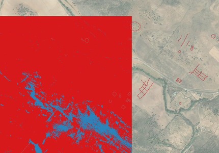
The course takes place at the headquarters of the Sanisera Archaeology Institute in Ciutadella de Menorca, where the laboratory is located and where students work on their personal computers. It is a course focused above all on laboratory work. The working day is always 5.5 hours. During the first week the training concentrates on the technology: GIS (QGIS or ArcGIS), LIDAR, Digital Elevation Models, photogrammetry, satellite imagery and Claude Al, and on the processing of the information generated for each of the four case studies: the harbour of Sanitja, Cala Pregonda, Cala Tamarells with Ses Llanes, and Ses Fontanelles in Algaiarens.
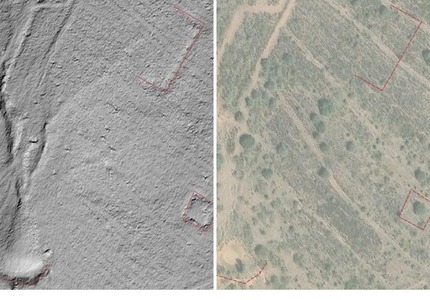
At a more advanced stage of the course the field trips are planned, to recognise on the ground the evidence detected in the laboratory. As the course is held in summer, these outings are short and take place first thing in the morning, always finishing by 10.30 am at the latest, before the heat becomes intense. The rest of the working day on those dates is devoted in the laboratory to analysing what was observed and writing up the results, which each student adds to their study diary and final report.
The bathymetry of the four case studies follows the same rule. Each site is surveyed in one or two early-morning outings on days with calm sea, starting with the harbour of Sanitja, the most sheltered of the four, and continuing with Cala Pregonda, Cala Tamarells and Ses Fontanelles when the conditions on the north coast allow it, with two students per kayak taking turns while the rest of the group records the control points from the shore. Life jackets are compulsory and the outing is cancelled if the wind or the swell make it unsafe or make the readings unreliable. The soundings are processed in the laboratory that same day and added to the GIS project of each case.
The course lasts 16 days: the first is devoted to the formal presentation of the programme, the laboratory and the four case studies, eleven are course days and four are days off.
The course is taught in English.
Certificates
At the end of the course students receive a certificate of participation stating the hours and the activities completed.
Participants with outstanding performance may request a letter of recommendation from the organization.