


 063: Reconstruction of the ancient harbours of Menorca: GIS, LIDAR, bathymetry and underwater archaeology (Ciutadella, Menorca - Spain)

General Information
The Sanisera Archaeology Institute for International Field Schools, based in Menorca since 1993, trains students from all over the world in field and laboratory archaeology, with a long track record at the Roman harbour of Sanitja and in the underwater survey of its surroundings. This course brings that experience together with the digital tools that now make it possible to study the coast without diving.
The training consists of reconstructing the ancient shape of several harbours and anchorages of the island by combining Geographic Information Systems, LiDAR, bathymetry, aerial and satellite imagery and the data of the underwater Archaeological Chart of Menorca, and then checking on the ground, on foot and along the shore, whether the laboratory calculations match real remains.
The starting point is the GIS project applied to the underwater archaeology of Menorca carried out in 2020 by F. Contreras and A. Fernández and published in Virtual Archaeology Review (13, 27, 2022). That work integrated the 285 elements of the Archaeological Chart with winds, waves, currents and the seabed, classified one hundred anchorage areas according to their quality and proposed an approximate reconstruction of the coastline around 1000 BC based on erosion and sea-level rise.
From those results come the four case studies of the course. The first two are harbours whose shape has changed markedly: at Sanitja, the sea reached much further inland and Roman ships could anchor well beyond what can be seen today; at Cala Pregonda, next to the early imperial site of s'Embarcador de s'Alairó, a small harbour may have existed that is now buried or submerged. The other two are areas that the analysis identified as excellent for anchoring but which have hardly any archaeological record: Cala Tamarells with the anchorage of Ses Llanes, sheltered by the Illa d'en Colom, and Ses Fontanelles, in the Algaiarens area. Both territories offer the conditions for prehistoric, Roman and Islamic settlements that remain to be documented.
In each of the four case studies the course goes one step further and carries out its own bathymetric survey of the harbour, cove or stretch of coast concerned, using a fishing echo-sounder with built-in GPS and an RTK GNSS receiver mounted on a kayak. The same method is applied at the harbour of Sanitja, Cala Pregonda, Cala Tamarells with Ses Llanes and Ses Fontanelles in Algaiarens.
The result, for each site, is a digital model of the seabed with depth contours every 0.5 m, georeferenced with centimetre precision in plan and an estimated 10 to 20 cm in depth over sand and rock. This preliminary, low-resolution bathymetry is used to locate anchorages, submerged structures and wrecks, to plan future underwater survey with divers, to support drone photogrammetry in the shallow zone and to join the seabed with the LiDAR of the land in the reconstruction of the ancient coastline.
The Four Harbours Under Study • Click any map to enlarge
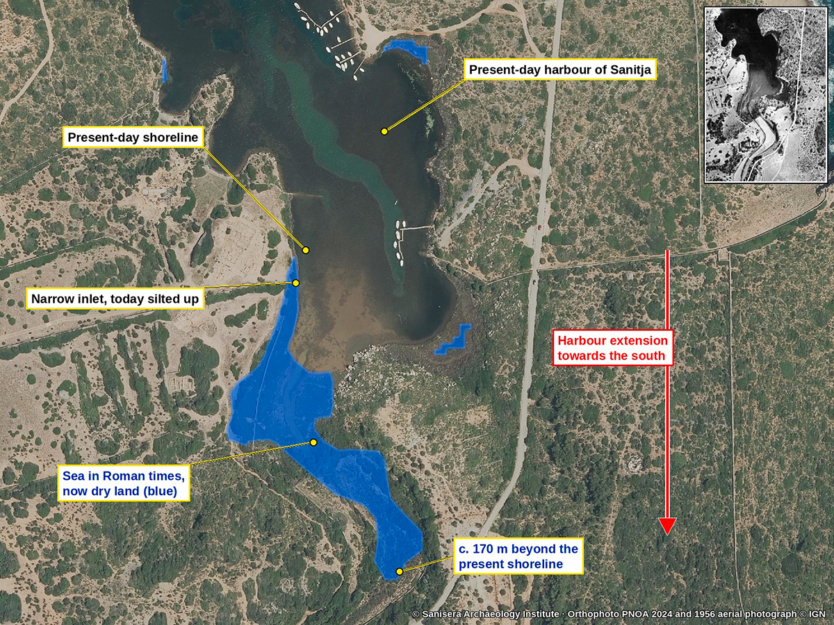 The harbour of Sanitja in Roman times
: the sea reached about 170 m further south than the present shoreline
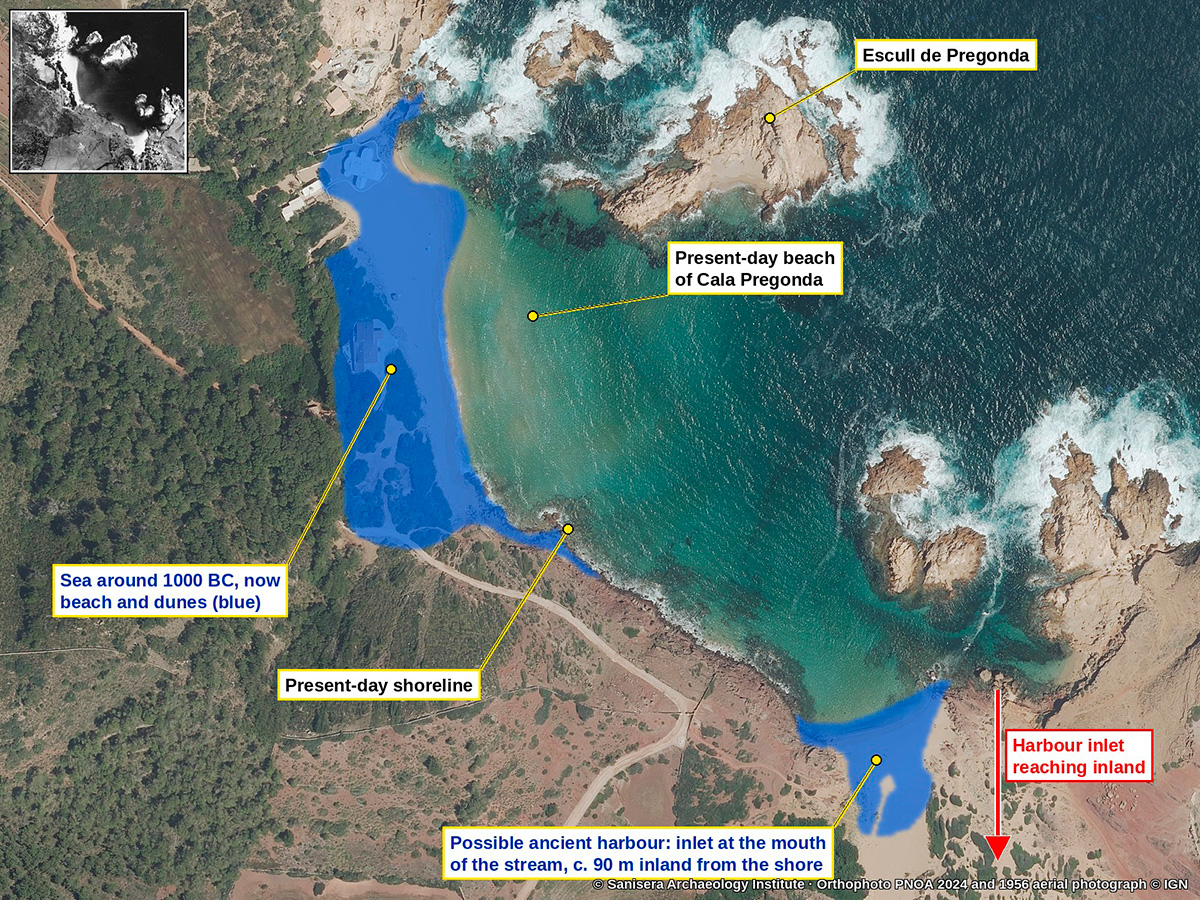 Cala Pregonda ancient harbour reconstruction
Cala Pregonda and the possible ancient harbour at the mouth of the stream, next to the early imperial site of s'Embarcador de s'Alairó
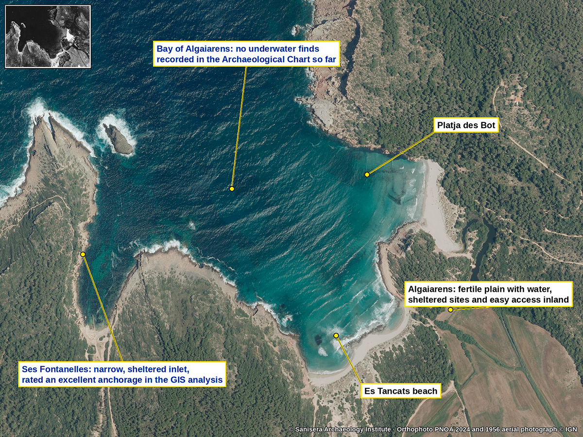 Ses Fontanelles and Algaiarens anchorage
Ses Fontanelles and the bay of Algaiarens, an excellent anchorage with hardly any archaeological record so far
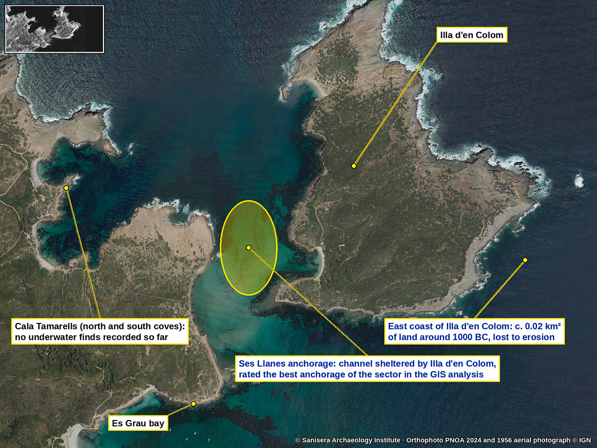 Cala Tamarells, Ses Llanes & Illa d'en Colom
Cala Tamarells, the anchorage of Ses Llanes and Illa d'en Colom, the sector with the best anchoring conditions in the GIS analysis
© Sanisera Archaeology Institute. Orthophoto PNOA 2024 and 1956 aerial photographs Instituto Geográfico Nacional. Reconstruction after Contreras & Fernández (2022), Virtual Archaeology Review 13(27).