AT THE MOMENT REGISTRATION IS CLOSED TO THE COURSES BELOW. We want to challenge COVID-19 and we are going to start promoting our projects that will start in May 2021. We will do it slowly, and progressively if conditions improve, waiting to see how this pandemic evolves. Check which courses you can enroll in
007. Dig in the Roman City of Sanisera and GIS applied in Archaeology
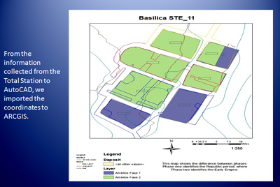
 Fieldwork focuses on the excavation of an urban area where a monastery has been found. In the laboratory students will learn to classify artifacts, including Roman pottery, numismatics and faunal remains. Participants will also learn and use mapping tools applied to archaeology as well as topography, photogrammetry and archaeological recording systems with GIS (Geographic Information System).
009. Fieldwork in the Necropolis of Sanisera and GIS Applied in Archaeology
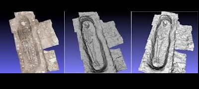
 Fieldwork focuses on the excavation of funerary structures, specifically inhumation graves. In the laboratory students will learn to classify artifacts found, mainly human skeletal remain. Participants will also learn mapping tools applied to archaeology as well as topography, photogrammetry and archaeological recording systems with GIS (Geographic Information System).
011. Total Station & GIS applied in archaeology.
 This course focuses on archaeology, anthropology and mapping tools applied to archaeology as well as topography, photogrammetry and archaeological recording systems with GIS (Geographic Information System).
![]() General Information What you will learn Useful Information Staff Sessions & Cost
General Information What you will learn Useful Information Staff Sessions & Cost
012. Discover Amphora & Shipwrecks in the Underwater Port of Sanitja & GIS Applied in Archaeology

This course focuses on underwater survey, Mediterranean ship building techniques, and ARGIS software. The aim is to identify underwater structures of the Roman city of Sanisera and shipwrecks, as well as anchors and amphorae related to those shipwrecks and its cargoes. Then, participants will create an archaeological GIS platform from the applied recoding system of the ancient port of sanisera.
![]() General Information What you will learn Useful Information Staff Sessions & Cost
General Information What you will learn Useful Information Staff Sessions & Cost
042 Total Station, AutoCAD & Archaeological Techniques of drawing, photography and digital illustration
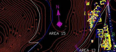
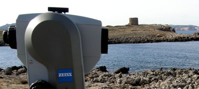
This program is divided in two main parts: Using an Electronic Total Station to create maps in a CAD drawing file and laboratory techniques used with archaeological material. In the first part of the course, participants will prepare a Topographic Data Base of the site using an Electronic Total Station, in order to create a DEM (Digital Elevation Model) and archaeological maps in a CAD drawing file. In this way, students will also learn how to use an Electronic Total Station, as well as software like AutoCAD. In the second part the students will practice the techniques that are used in an archaeological laboratory so that they can register the main objects found on a site with the highest quality. The development of those techniques will help us to obtain drawings, photographs and digital archives that will be extremely useful for the elaboration of publications, reports or further studies.
![]() General Information What you will learn Useful Information Staff Session & Cost
General Information What you will learn Useful Information Staff Session & Cost


