

 Research and Publications
History of Research
Long before the first excavation, Sanisera was a name in Pliny, a word on sailors’ charts and a story told by the farmers of Cap de Cavalleria. This page follows the search for the Roman town, from the classical sources to the surveys that preceded our field school. The publications that came out of our own excavations are listed under Sanisera (Field School).
Topics: The name Sanisera · Sanisera on nautical charts · Scholars and legends (18th–20th centuries) · Chance finds and first excavations (1950–1984) · A pause in fieldwork (1984–1993) · Land and underwater surveys (1993–2001) · The field school · References
The name Sanisera
Pliny the Elder names Sanisera as one of the three towns of Menorca, with Iamo and Mago (Natural History III, 77). It is the only ancient text that mentions it. Livy’s account of the conquest of the Balearic Islands by Quintus Caecilius Metellus in 123 BC survives only in a short summary (Periochae 60), which says nothing about the towns. R. Zucca (1998) places Sanisera in the wider history of the Roman Balearic Islands.
In 123 BC the bay of Sanitja was the best anchorage on the north coast of Menorca. A ridge of rock some 200 m long runs underwater from Cap de Cavalleria to the islet of Porros and works as a natural breakwater against the north wind, the tramuntana; the neighbouring bay of Fornells has a far more dangerous entrance. The Roman settlement was built on a low hill, 15 to 20 m above sea level, just south of the harbour, with a view over the port and a long stretch of the coast.
The origin of the name is unknown. No parallel has been found among Latin or pre-Roman place-names in the Mediterranean. J. S. Hernández divided it into two elements, sani- and -sera. The first may be related to the Iberian personal-name element sani-, recorded on a silver bowl from Tivissa and on lead tablets from Pech Maho (Siles 1985; Velaza 1991). For the second, the only hypothesis is the Indo-European root *ser-, “to flow” (Pokorny 1959), which would refer to the stream that runs into the harbour. Both readings remain hypothetical. A. Jaquemot later returned to the question in “El topònim preromà de Sanisera” (2007).
Sanisera on nautical charts
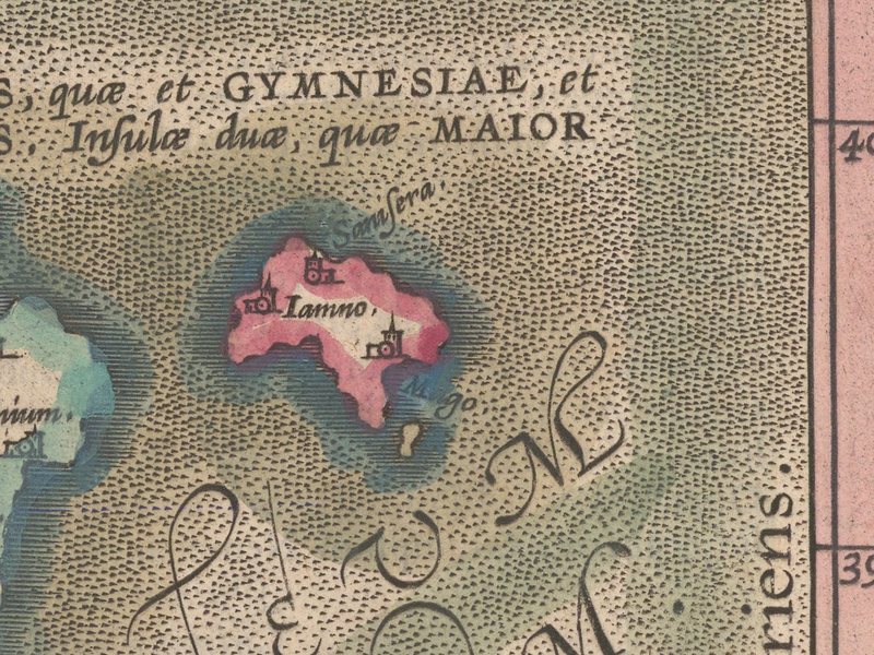
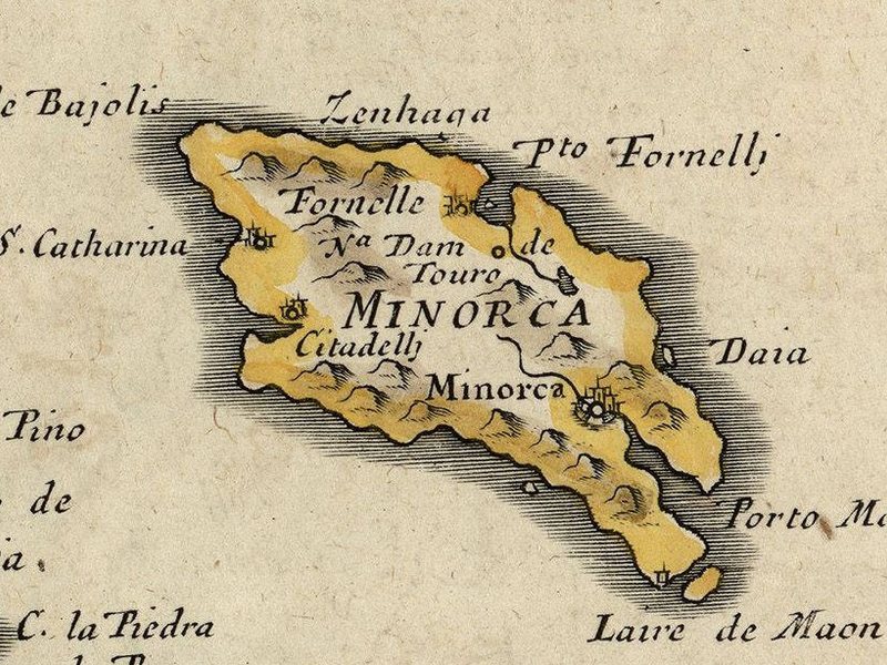
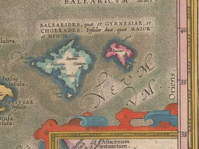
Medieval and early modern sailors needed to know where to find shelter in bad weather, and the harbour of Sanitja appears on many of their charts. Its name changes from one chart to the next, but it stays close to the ancient form. These names show that the bay remained a known anchorage through the Islamic and medieval periods, and they were among the first clues that pointed scholars to Sanitja. On the map of ancient Hispania published by Abraham Ortelius in 1586, Sanisera is already placed on the north coast of Menorca.
| Chart or source | Date | Name of the harbour |
|---|---|---|
| Pere Martell (account of) | 1228 | Sereyna |
| Carta Pisana | c. 1275 | Sendia |
| Compasso da navigare | 1296 | Porto Senello |
| Giovanni da Carignano | c. 1300 | Seneua |
| Anonymous, Pisa | c. 1300 | Senoly |
| Pietro Vesconte | 1313 | Soneli |
| Pietro Vesconte | 1318 | Senelli, Senoli |
| Angelino Dulcert | 1339 | Seneli |
| Laurentian (Medici) Atlas | 1351 | Seneli |
| Cresques Abraham and Jafuda Cresques, Catalan Atlas | 1375 | Sanitja |
| Pinelli-Walckenaer chart | 1384 | Senige |
| Guillem Soler | 1385 | Senige |
| Anonymous, Estense | 15th c. | Sonia |
| Mecià de Viladestes | 1413 | Seniga |
| Archive of the Crown of Aragon | 1420 | Ceniya |
| Battista Beccari | 1426 | Seniga |
| Jacobus de Giroldis | 1426 | Seniglles |
| Andrea Bianco | 1436 | Senigta, Senigla |
| Gabriel de Vallseca | 1439 | Seniia |
| Anonymous Italian portolan | mid-15th c. | Senitja |
| Pere Rosell | 1447 | Sema |
| Pere Rosell | 1462 | Senia |
| Grazioso Benincasa | 1468 | Cenegta |
| Ignasi M. Colomer | c. 1480? | Senoli |
| Arnau Domènech | 1486 | Senitja |
| Anonymous Catalan | 1487 | Seniga |
| Jaume Bertran | 1489 | Seniga |
| Nicolaus Germanus | 1495 | Seneli |
| Jehuda ben Zara | 1497 | Sinia |
| Conte Freducci | 1497 | …ega |
| S. Magüerza collection | 16th c. | Cenega |
| Anonymous chart | c. 1500 | Senege, Cenega |
| Vesconte Maggiolo | 1512 | Zenaga |
| Pierre Desceliers | 1526 | Sonige |
| Jacobus Russus | 1535 | Séneca |
| Bartomeu Olives | 1538 | Sauia |
| Giorgio Calapoda | 1552 | Cenegla |
| Domingo Olives | 1568 | Ceniose |
| Jaume Olives | 1571 | Saniye |
| Bartomeu Olives | 1584 | Seniya |
| Abraham Ortelius | 1586 | Sanisera |
| Joan Martines | 1587 | Cenegla |
| Anonymous portolan | c. 1600 | Ceneg |
| Jean de la Haye | 17th c. | Zenega |
| Pierre Bertius | 1618 | Zenega |
| Anonymous French | 1645? | Ianisera |
| Nicolas Sanson d’Abbeville | 1653 | Zenhaga |
| Joannes Janssonius | 1657 | Sanisera |
Compiled for the Sa Nitja research report (1995). Dates are those given by the catalogues of each chart. On the old place-names of the islands, see Coromines and Mascaró Passarius (1989) and Mascaró Passarius (2000).
Scholars and legends (18th–20th centuries)
The first scholarly descriptions of Menorca date from the late 18th century. Juan Ramis y Ramis noticed the likeness between the names Sanitja and Sanisera, and José Vargas Ponce, a naval officer who charted the Balearic coasts for the Spanish Navy, put it in print in 1787. He noted that Pliny names a town, Sanisera, that no other author mentions; that near Mercadal there is a large bay called Sanitja, a name close to Sanisera; and that ancient ruins can be seen at the head of that bay, which might belong to the town (Vargas Ponce 1787: 44). Later Menorcan scholars, among them F. Oleo and J. M. Quadrado, accepted the identification.
In Die Balearen (1891), Archduke Ludwig Salvator of Austria described the “great inlet” where Sanisera seemed to have stood and whose remains, he wrote, were still visible until recently. In 1927 J. Cotrina again argued for a Roman settlement in the harbour. Others were less sure. A. García y Bellido (1947) still called Sanisera “unknown” and placed it, as A. Schulten had done, near Alaior. A. M. Muñoz (1974) wrote that there was no information on the town and that its location was not known.
The local people had their own explanation. Storms and rain uncover walls, pottery and objects, and the farmers and fishermen of Cavalleria made up stories to account for them. Francesc Camps i Mercadal recorded one of these stories in his Folklore menorquí de la pagesia (1918–1921). Madò Alzina, of the Santa Teresa farm, told him that a bishop was buried by the harbour, at a place called Ses Vilotes de Sanitja, where there were traces of an old town, and that on calm days houses could be seen under the water.
Chance finds and first excavations (1950–1984)
In the 1950s the Association of Oceanographic Studies and Underwater Archaeological Recoveries was founded in Ciutadella, with J. Mascaró Passarius among its promoters. Its members made free-diving surveys in shallow water along the coast of Menorca, including the mouth of Sanitja. Mascaró described this work and later recorded the site in his archaeological map of Es Mercadal (Mascaró Passarius 1955; 1980).
The first objects from the harbour mouth to be published reached the Museum of Menorca in 1974, donated by two maritime clubs in Maó and Es Castell. They included four necks of large Late Roman amphorae from Byzacena, in present-day Tunisia, a type made to carry olive oil. Two of them are stamped: one reads LEPMI / BSCD, that is Lep(tis) Mi(nor), and the other TEP / KOP (De Nicolás 1980: 55–58, fig. XIII). From the Pas de Sanitja came two Punic amphorae of Mañá B type and a Roman Dressel 2–4, together with Late Roman amphora toes and fragments of Baetican amphorae (De Nicolás 1974). One amphora from the Pas, published as Punic (De Nicolás 1983: 213, fig. 18), was later shown by our underwater surveys to be an Iberian flat-rimmed amphora from a Late Republican wreck, whose mixed cargo also held Italian Dressel 1 and Ebusitan PE-17 amphorae.
In 1977 J. C. de Nicolás published the first account of the remains visible on the surface. He identified two areas. On the hill by the harbour mouth, east of the stream, he found the oldest pottery (Campanian A, Graeco-Italic and Republican amphorae, Iberian and Talayotic wares) and stretches of large stone walls. West of the stream lay abundant terra sigillata, with African Red Slip Ware of the 2nd–4th centuries AD. Further away he saw house foundations and part of a cemetery. He concluded that the remains of Pliny’s Sanisera would one day be found at Sanitja (De Nicolás 1977: 120).
Between 1979 and 1984 a team led by C. Rita Larrucea carried out the first surveys and excavations on the site (Rita Larrucea et al. 1988). They estimated that the town covered about 6 hectares and dated its occupation from the Roman conquest of 123 BC to the 6th century AD. They excavated Building C, a block of eight rectangular rooms: some were storerooms and others held a set of connected tanks lined with opus signinum, used to make wine. Fish-salting or purple-dye production may also have taken place there. The building seems to have been abandoned early in the 6th century AD. The team also partly excavated a building whose plan suggested an Early Christian basilica.
A pause in fieldwork (1984–1993)
After 1984 there was no further excavation or survey for almost ten years. Work went on in museums and archives. J. Ramon recorded Punic and Ebusitan amphorae from the harbour from his first study of Ebusitan amphora production onwards (Ramon 1981; 1991) and again in his doctoral thesis, published by the University of Barcelona (Ramon 1995). J. C. de Nicolás published two studies that include material from Sanitja. With M. J. Conde he catalogued the painted Iberian pottery of the Balearic Islands, including sherds from Sanitja that probably come from the area of the Republican military camp (De Nicolás 1983; De Nicolás and Conde 1993). He also published the Early Christian orange and grey wares of Menorca (De Nicolás 1994), among which the group from Sanitja is the largest on the island.
De Nicolás had already gathered the inscribed finds from the site. His catalogue of stamped amphorae from Menorca includes five amphorae from Byzacena found in the harbour, among them the LEPMI / BSCD neck and one stamped CHIVL, which he read as a mark of Hadrumetum (De Nicolás 1980: 55–58). In his study of Roman Menorca he added the rest, most of it picked up on the surface by J. Sánchez of Ciutadella: 27 potters’ stamps on Italian and 12 on South Gaulish terra sigillata, a pre-Arretine sherd stamped C·SE, stamps on Dressel 2–4, Laietanian and Baetican Dressel 20 amphorae (L·E…, …IV CAV / SVR, AT, C·VET…, LIVN…/E… and MA…) and a fragment of a marble inscription (De Nicolás 1983: 255–275). Of the 130 lead sling bullets from Menorca that he studied, only two are inscribed, and both come from Sanitja: one reads SCAE and the other S·S·(C?) (De Nicolás 1983: 246–251). The excavators of the Roman camp later read the first as Q(uintus) CAE(cilius) and linked it with Q. Caecilius Metellus Pius and the Sertorian War (Contreras Rodrigo et al. 2006). J. López Vilar (2013) reads SCAE instead as the beginning of a name and dates the bullets to Caesar’s campaign of 49 BC.
Other chance finds from the site have also been published. A private collection, probably that of J. Sánchez, held nearly a hundred fragments of Early Christian lamps (De Nicolás 1977: 122). From the surface come eight bronze fish-hooks, now in the Municipal Museum of Ciutadella, and folded lead weights from circular cast nets, probably found near the Late Republican camp (De Nicolás 1983: 281; 2015: 25, 165), as well as a Roman ring of the 1st–2nd centuries AD set with a carnelian intaglio of Victory (De Nicolás 2018). Near the cemetery basilica now being excavated lay part of a limestone table top with a lion protome, later reused as an Early Christian mensa and now in the Museum of Menorca (Rita Larrucea 2020). A sandstone sarcophagus with its lid, found at Ses Vilotes de Sanitja at the foot of the same basilica, was recorded by Mascaró Passarius (1980: 37, 44–46). In 2003 a complete Baetican Dressel 23 olive-oil amphora, found by divers near the harbour mouth, was given to the Museum of Menorca (inv. 76843).
Earlier, with R. Tejedor, De Nicolás had published a Roman anchor stock of about 26 kg found at the harbour entrance, some 200 m from the shore and 25 m deep (De Nicolás and Tejedor 1974). C. Rita Larrucea published the Late Roman African amphorae of the site (Rita Larrucea 1994).
Land and underwater surveys (1993–2001)
Fieldwork started again in 1993 with a research project funded by the Fundació “la Caixa” to protect and present the Roman town. The Sa Nitja association, which managed the Ecomuseum of Cap de Cavalleria, carried out land surveys and underwater surveys in 1994 and 2001. The results were set out in a four-volume research report (Sa Nitja 1995) and published in the Annals de l’Institut d’Estudis Gironins (Contreras Rodrigo et al. 1997).
The first step was to study a collection of material from the harbour donated to the association by J. C. de Nicolás. Its earliest fine wares and amphorae date from the years around the Roman conquest. Its latest pieces, African Red Slip Ware D of Hayes form 105 and Keay LXI amphorae, carry the occupation into the 7th century AD. More than half of the fine pottery (53.3%) came from North Africa, while North African amphorae made up only 21.4% of the amphorae.
The field school
The surveys led to the systematic excavation of the site, and students have taken part in the work since 1996. Each season of the field school has added to the history of Sanisera: the Roman Republican camp, the town and its harbour, the Late Antique ecclesiastical complex and its necropolises, and the shipwrecks of the bay. The results are published in the journals and books listed under Sanisera (Field School). MA and PhD students who wish to study our material can find out how under Research Opportunities.
References
Camps i Mercadal, F. (1918–1921). Folklore menorquí de la pagesia. 2 vols. Maó.
Contreras Rodrigo, F.; Hernández, J. S.; Segura, M.; Esteban, J.; Kirchner, H.; Pujol i Canelles, M. (1997). Sa Nitja. Gestió del patrimoni mediterrani: resultats de les campanyes de prospecció a la ciutat romana de Sanisera (Es Mercadal, Menorca). Annals de l’Institut d’Estudis Gironins 38: 1649–1669.
Contreras Rodrigo, F.; Müller, R.; Valle de Tarazaga, F. J. (2006). El asentamiento militar romano de Sanitja (123-45 a.C.): una aproximación a su contexto histórico. Mayurqa 31: 231–249.
Coromines, J.; Mascaró Passarius, J. (1989). Toponímia antiga de les Illes Balears. Barcelona: Curial.
Cotrina, J. (1927). Sobre las ruinas de Sanitja. Revista de Menorca: 83–86. Maó.
De Nicolás, J. C. (1974). Ánforas africanas del Bajo Imperio en Sanitja, Mercadal, Menorca. Menorca Subacuática 3.
De Nicolás, J. C. (1977). Notas de actualización de los capítulos I y II. In M. L. Serra et al., Historia de Menorca I: 120. Maó.
De Nicolás, J. C. (1980). Epigrafía anforaria en Menorca. Maó: Ateneo Científico, Literario y Artístico de Mahón; Centro de Investigaciones Submarinas de Menorca.
De Nicolás, J. C. (1983). Romanización de Menorca. In J. Mascaró Passarius (ed.), Geografía e Historia de Menorca IV: 201–283. Menorca.
De Nicolás, J. C. (1994). Sigillates paleocristianes ataronjades i grises a l’illa de Menorca (Balears). In III Reunió d’Arqueologia Cristiana Hispànica (Maó, 1988): 311–320. Barcelona: Institut d’Estudis Catalans.
De Nicolás, J. C. (2015). L’aprofitament dels recursos de la mar a la prehistòria i l’antiguitat menorquina i altres activitats vinculades. Publicacions des Born 23–24: 151–200. Ciutadella: Cercle Artístic.
De Nicolás, J. C. (2018). Anells romans de Menorca, 1. Arqueomenorca, monografies 82.
De Nicolás, J. C.; Conde, M. J. (1993). La ceràmica ibèrica pintada a les Illes Balears i Pitiüses. Col·lecció Recerca 3. Maó: Institut Menorquí d’Estudis.
De Nicolás, J. C.; Tejedor, R. (1974). Arqueología submarina en Menorca: cepos de ancla romanos. In Prehistoria y arqueología de las Islas Baleares. VI Symposium de Prehistoria Peninsular (Palma, 1972). Barcelona.
García y Bellido, A. (1947). La España del siglo primero de nuestra era (según P. Mela y C. Plinio). Buenos Aires: Espasa-Calpe.
Jaquemot Ballarin, A. (2007). El topònim preromà de Sanisera. Butlletí de la Societat d’Onomàstica 104–105: 197–202.
Ludwig Salvator of Austria (1891). Die Balearen in Wort und Bild geschildert. Leipzig: Brockhaus. Spanish translation by C. and B. Sánchez-Rodrigo, Ciutadella, 1979.
López Vilar, J. (2013). Glandes inscriptae a l’ager Tarraconensis. In J. López Vilar (ed.), Govern i societat a la Hispània romana. Novetats epigràfiques. Homenatge a Géza Alföldy: 175–184. Tarragona: Fundació Privada Mútua Catalana.
Mascaró Passarius, J. (1955). Las exploraciones arqueológicas submarinas en Menorca. Revista Tramontana.
Mascaró Passarius, J. (1980). Carta arqueológica del término de Es Mercadal (isla de Menorca). Palma.
Mascaró Passarius, J. (2000). La toponímia i cartografia antigues de les Illes Balears. Palma: Lleonard Muntaner.
Muñoz, A. M. (1974). Fuentes escritas griegas y romanas sobre las Baleares. In Prehistoria y arqueología de las Islas Baleares. VI Symposium de Prehistoria Peninsular (Palma, 1972): 7–29. Barcelona.
Pliny the Elder. Natural History III, 77.
Pokorny, J. (1959). Indogermanisches etymologisches Wörterbuch. Bern: Francke.
Ramis y Ramis, J. (1817). Inscripciones romanas que existen en Menorca. Maó: P. A. Serra.
Ramon, J. (1981). La producción anfórica púnico-ebusitana. Ibiza: Congrés de Cultura Pitiusa; Delegación Insular del Ministerio de Cultura.
Ramon, J. (1991). Las ánforas púnicas de Ibiza. Trabajos del Museo Arqueológico de Ibiza 23. Eivissa.
Ramon, J. (1995). Las ánforas fenicio-púnicas del Mediterráneo central y occidental. Col·lecció Instrumenta 2. Barcelona: Universitat de Barcelona.
Rita Larrucea, C. (1994). Ánforas africanas del Bajo Imperio romano en el yacimiento arqueológico de Sanitja (Menorca). In III Reunió d’Arqueologia Cristiana Hispànica (Maó, 1988). Barcelona: Institut d’Estudis Catalans.
Rita Larrucea, C. (2020). Un fragment de mensa romana amb pròtoma de lleó trobat a Sanitja (Es Mercadal). In VIII Jornades d’Arqueologia de les Illes Balears: 299–308.
Rita Larrucea, C.; Latorre, J. I.; Orfila, J. A. (1988). Las excavaciones arqueológicas en el yacimiento de Sanitja (Menorca) hasta 1984. In P. de Palol (dir.), Les Illes Balears en temps cristians fins als àrabs: 41–49. Ciutadella: Institut Menorquí d’Estudis.
Sa Nitja (1995). Memòria de recerca: la ciutat romana de Sanisera. Directed by F. Contreras Rodrigo. 4 vols. Unpublished report, Fundació “la Caixa”; Servei d’Arqueologia, Consell Insular de Menorca.
Siles, J. (1985). Léxico de inscripciones ibéricas. Madrid: Ministerio de Cultura.
Vargas Ponce, J. (1787). Descripciones de las islas Pithiusas y Baleares. Madrid: Viuda de Ibarra.
Velaza, J. (1991). Léxico de inscripciones ibéricas (1976–1989). Aurea Saecula 4. Barcelona: Universitat de Barcelona.
Zucca, R. (1998). Insulae Baliares. Le isole Baleari sotto il dominio romano. Rome: Carocci.